
Riverfly Update
by Hannah Parry-Wilson
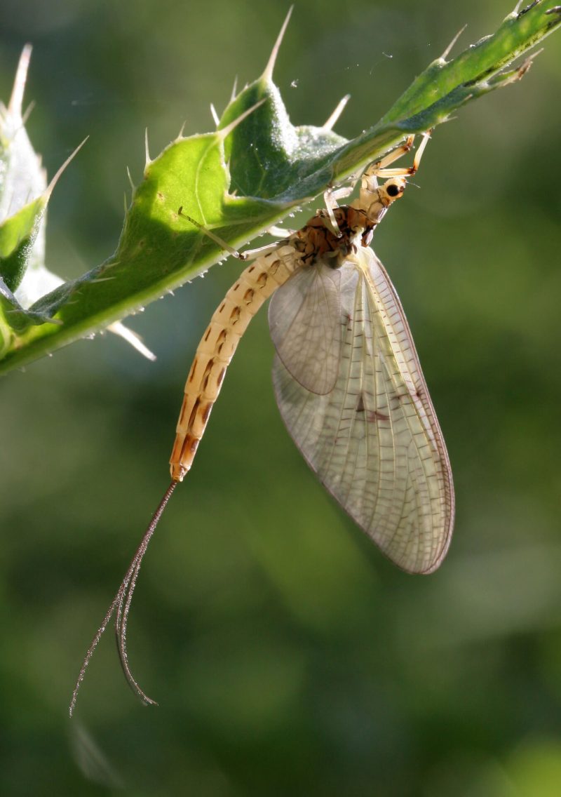
Riverfly is a citizen science method of investigating water quality and chalk stream health by recording the presence and abundance of riverflies.

We’ve been involved with Riverfly in the Chilterns since 2010, recording long-term data as part of the national Riverfly Partnership.
Dedicated citizen scientists have been monitoring each of our Chilterns chalks streams on a monthly basis for over a decade.
We set up up monitoring sites around key features of interest, such as sewage treatment works outfalls, restoration projects, up and downstream of urban areas, etc.
To ensure that we can continue to track water quality over time, we need new Riverfly monitors for almost every chalk streams in the Chilterns AONB.

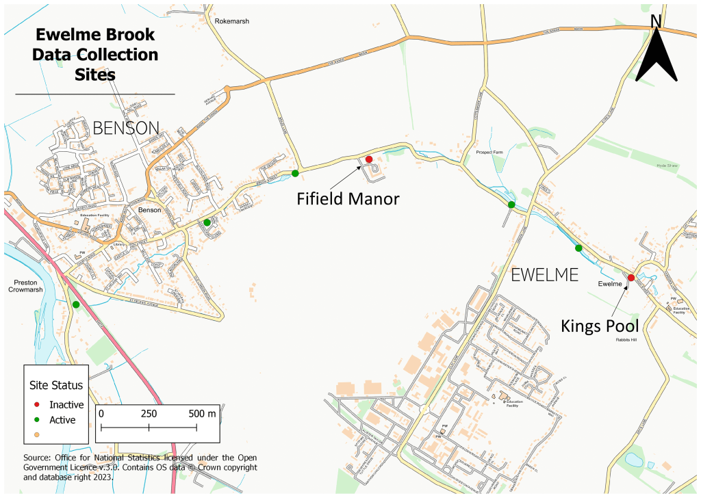
Ewelme / Benson Brook
The Ewelme brook runs from just above Ewelme watercress beds, flowing north of the RAF base and culverted for 0.27 km before it appears again at Benson.
The culvert separates Ewelme and Benson, creating a barrier for wildlife between the two areas.
The brook is currently the focus of much restoration work carried out with the local community and Benson Nature Group.
Riverfly monitoring will help us to track any ecological successes as a result of this work.
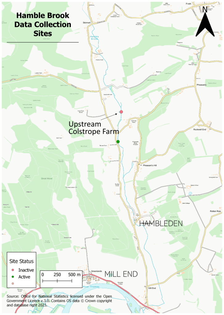
Hamble Brook
The Hamble Brook has been subject to one of the largest known restoration projects on a winterbourne stream, undertaken over 1.2 km in March 2023.
Riverfly is currently conducted on a single site on the brook, which can only be carried out during periods of flow.
As a result of the restoration work, we have attempted to set up a monitoring site upstream of Colstrope Farm at the top end of the project reach, but have only managed to collect data once in May 2023 ourselves.
We’re planning on setting up dry riverbed sampling to look at the invertebrate ecology of winterbournes, but we’re also keen to look at whether the Hamble Brook may be home to rare winterbourne endemic species of riverfly during flowing periods too.
River Wye
The River Wye is monitored by a dedicated group of volunteers, part of the Revive the Wye conservation group.
The River Wye has some fantastic long-term Riverfly data and has recently been the subject of some restoration work at Barrowcroft, High Wycombe.
More Riverfly monitors are needed, however, to collect monthly data at key sites throughout the course of the river.

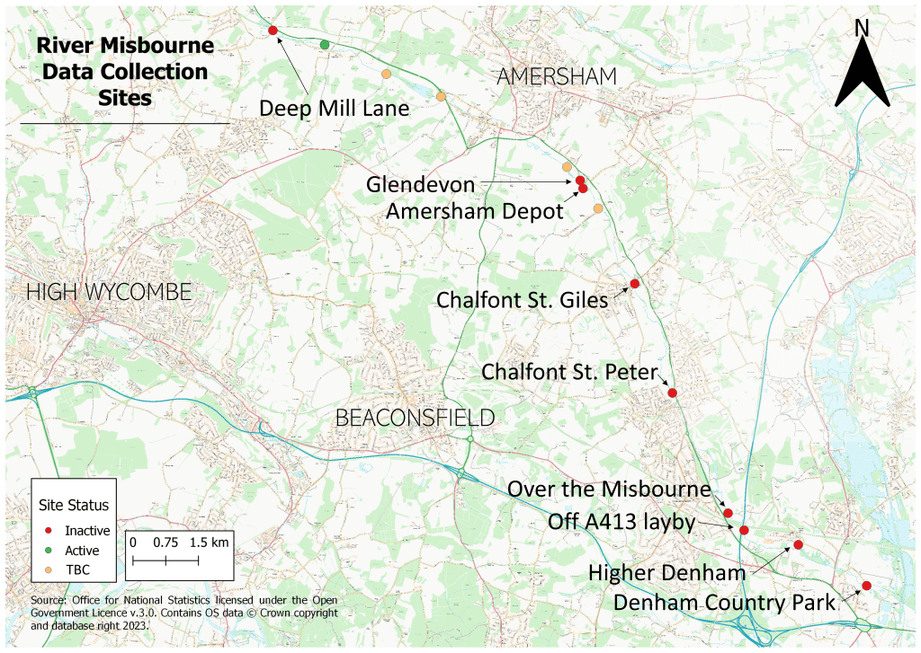
River Misbourne
The Misbourne has faced many problems over the past decade, including drought that caused over 55% of the river to become dry in 2019, causing fish kills.
The river has always suffered low flows, partially due to its geology that causes water to flow back into the aquifer along the course of the stream, known as losing reaches.
This has been a problem for Riverfly monitoring, as surveys cannot be completed when the river is dry!
This has meant that keeping up momentum for Riverfly monitoring has been tricky, so many previously monitored sites are now very much in need of new Riverfly monitors, especially to monitor new threats to this important chalk stream.
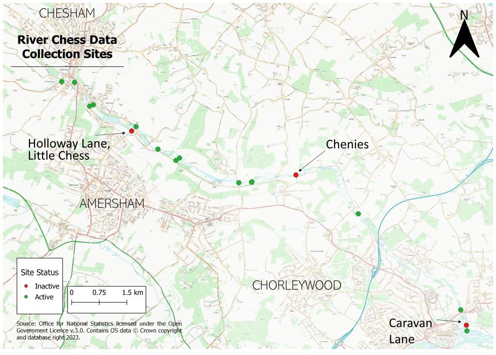
River Chess
The Chess has some active monitors that have been surveying the same sites since 2010.
Now the focus of a collaborative pilot catchment-based project called Smarter Water Catchment, the Chess is taking part in many citizen science surveys to look at the water quality and ecology.
These surveys also include a new national citizen science method called SmartRivers by Wildfish, designed to look specifically at environmental pressures impacting freshwater invertebrate populations.
River Bulbourne
The Bulbourne, a tributary of the River Gade, has been the focus of some impressive restoration projects, including the ‘Bringing Back the Bulbourne’ project near Box Moor in 2017.
The Bulbourne was last monitored for Riverfly in 2020, so is in great need of new monitors. This will help us understand the long-term impacts of restoration on chalk stream health.

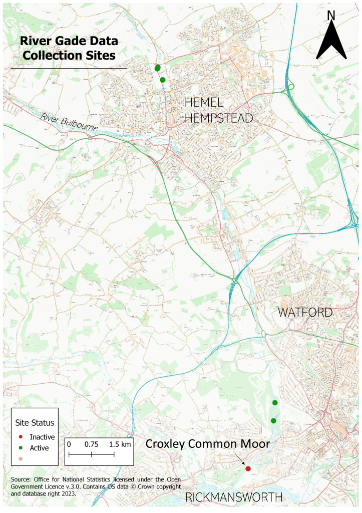
River Gade
The Gade and it’s tributary, the Bulbourne, are the streams most heavily impacted by human activity in the Chilterns, particularly south of Hemel Hempstead where the Gade is lost entirely to the Grand Union Canal in several places before it joins the Colne in Croxley.
The Gade is currently only monitored by a very small number of dedicated citizen scientists, therefore is in need of new Riverfly monitors to fill in gaps of data, both spatially and temporally.
River Ver
The River Ver is actually our most frequently monitored chalk stream throughout the whole of the Chilterns.
Led and organised by the Ver Valley Society, we now have extensive long-term data records for each active monitoring site that helps tells us how invertebrate populations react to pollution issues, drought events and much more.

Want to help with Riverfly monitoring?
We run training days every spring and autumn.
Our next training day on Saturday 23rd September is now fully booked, although we will happily add your name to our waiting list for upcoming training opportunities.
To add your name to our waiting list, please email our Citizen Science Co-ordinator, Hannah:


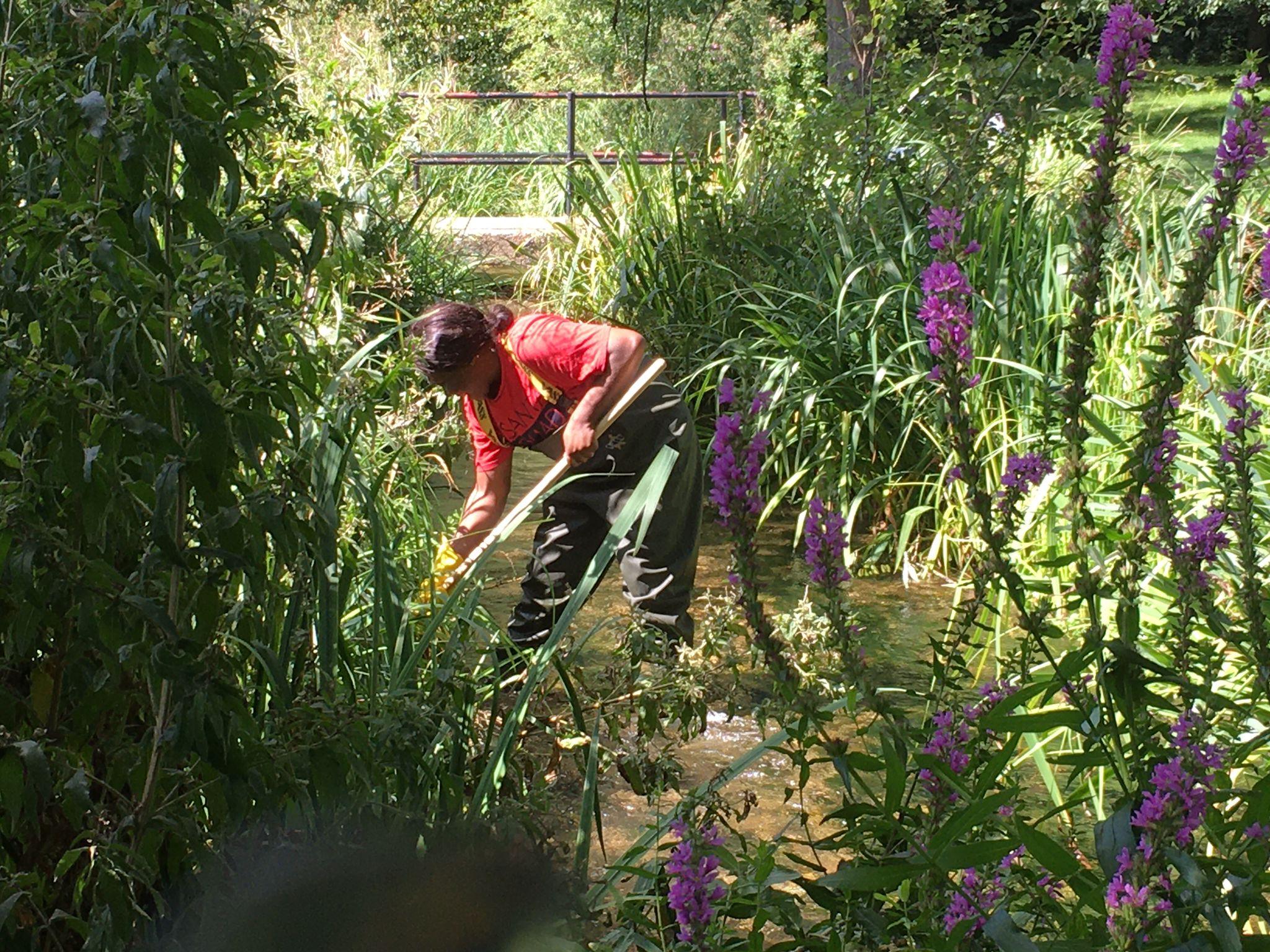


Citizen scientist at work
The Riverfly chalk stream maps that you will see in this news post were all created by our talented citizen scientist, Sian Hows.
This was Sian’s first project as a citizen scientist for the Chilterns Chalk Streams Project after having helped us with mapping for our recent NOSES report as part of the Smarter Water Catchment initiative, where she has brilliantly utilised skills from her career as a GIS mapping specialist.
Thank you Sian!